AISC creates solutions that deliver a 5D smart digital reality with insight into what was, what is, what could be, what should be, and ultimately, what will be. Our core strategy is to help nations, cities, and sites embrace a smart digital reality. This is accomplished through autonomous connected ecosystems that fuse indoor, outdoor, maritime, subterranean, and aerial data.
Smart City
Smart Cities employ 5D digital technology to improve urban flow management and support real-time response to challenges.
A Smart City brings together technology, government, and society. By fusing automation and IoT with real-time analytics capabilities, city leaders increase the quality of urban services and citizen engagement, while decreasing overall costs and resource consumption.

Smart Site
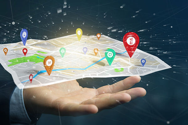
Real-Time Location Intelligence – Stay informed with live views and analytics from your site – whether it is indoors, outdoors, or below ground.
Smart Sites are secure, self-contained environments that employ 5D analytics solutions. Using the 5D platform from Hexagon’s Geospatial division, users can connect historical site data with real-time IoT sensor data, providing site managers with advanced location intelligence that supports smarter, more streamlined operations.
Manage the Data Avalanche – We integrate data from a variety of sources – including GIS, CAD, and BIM – with dynamic sensor feeds, and help you make sense of it all.
Smart Utilities
Manage critical assets in your network with real-time business intelligence.
From visualizing dynamic information to delivering interactive maps to stakeholders, utilities solutions from AISC provide location intelligence and analytics to efficiently monitor the health of infrastructure above and below ground.

Smart Transportation
Digital Transformation in Transportation – Our solutions optimize safety, enhance planning, and streamline operations for air, maritime, rail, and road transportation.
Roads & Bridges – Leverage data and information to overcome the challenges of aging infrastructure, increasing traffic and freight, and decreasing budgets.
Rail & Transit – Overcome capacity and infrastructure challenges by enhancing planning and operational efficiency and improving asset and fleet management.
Aviation – Leverage real-time data visualization and analysis tools and mapping and charting software to optimize air traffic management and streamline flight planning.
Smart Government
To efficiently deliver public services, government agencies can answer their specific location intelligence questions and engage citizens using solutions from Hexagon’s Geospatial division to enable smarter and informed decision making.
Pioneering Technology for Public Services – We partner with authorities at all levels to deliver capabilities that enhance vital government functions – from national mapping and national security to public works and public safety.


Smart Nation
Smart Nations create smart digital realities so leaders and citizens can better visualize their surroundings.
AISC provides Smart Nation solutions that allow national and international leaders to better serve citizens. These solutions increase insight into what was, what is, what could be, what should be, and what will be, supporting a nation’s ability to protect the interests of its population.
Products, Platforms & Solutions for Location Intelligence

Power Portfolio
Power Portfolio is comprised of globally recognized and proven products that combine the best GIS, remote sensing, photogrammetry, and data management technologies available.

Luciad Portfolio
The Luciad Portfolio provides developers with a platform for building situational awareness and real-time location intelligence solutions.

M.App Enterprise
M.App Enterprise provides organizations with a platform for configuring Smart M.Apps, dynamic, interactive map applications that merge location and business data with enterprise workflows to solve specific problems.


