Intergraph Planning & Response

Rapidly and effectively detect, assess, and respond to threats.

products_isecurity_820x460

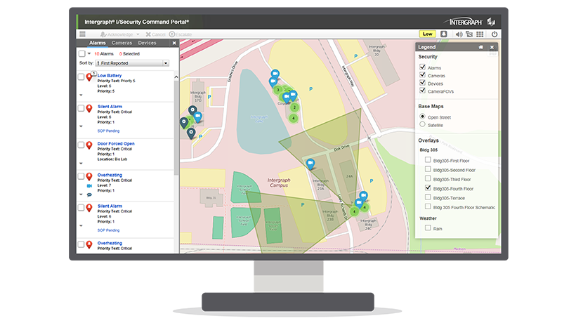
Intergraph Planning & Response is an application for emergency operations centers and mobile command staff to manage major events. Users can coordinate information and resources among diverse organizations at the strategic and tactical levels. Seamless integration with I/CAD enables additional coordination at the operational level for integrated incident management. Intergraph Planning & Response ensures efficient and effective processes and collaboration for planned major events and unplanned disasters and emergencies.


"The web-based approach helps us to integrate third parties including decentralized organizations on a case-by-case basis, all within the framework of overall rights management."

Günther Hohenberger - Head, Styrian Warning and Alarm Centre


Benefits
icon-public-safetySupport Frameworks

Leverage the easy-to-use IT system that supports command frameworks for emergency preparedness, response, and recovery.

icon-public-safetyMaximize Resources

Make the best use of limited, diverse resources through complete information for effective command processes and collaboration.

icon-public-safetyImprove Coordination

Prevent duplicate efforts, conflicting actions, unnecessary risk, confusion, and delays.


Capabilities
icon_technology_70x70Shared Information

Distribute and present information easily and securely, including real-time data, maps, and notifications.

icon_technology_70x70High Performance

Experience high performance and high availability. Disconnected mode and advanced geocaching ensure uninterrupted use.

icon_technology_70x70Configurable

Take advantage of highly configurable rules and workflow engine. Support for pre-defined templates and concept of operations.

icon_technology_70x70Easy to Use

Diverse organizations can easily deploy, manage, and use.

icon_technology_70x70Integrated GIS

Benefit from GeoMedia Smart Client, a user-friendly map platform that supports imagery and open web services.

icon_technology_70x70Application Modules

Leverage messaging, resource management, spatial analysis, timelines and calendars, mind mapping, victim care management, and more.

icon_technology_70x70I/CAD Integration

Create I/CAD events, link existing events, and monitor events and units.


German Federal Police

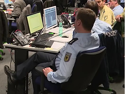
German Federal Police use specialized planning and response solution to separately plan, support, and manage special operations, while remaining connected to the CAD system.
G7 Summit

The Bavarian State Police and German Federal Police use computer-aided dispatch and response solutions for multi-agency coordination and collaboration.

 

Municipality of Canosa di Puglia

Municipality of Canosa di Puglia use monitoring, spatial data analysis, and response solution to detect and prevent environmental crime.
 

 Downloads

Training

Pricing